
Our Methods
The right method for the question beneath the surface.
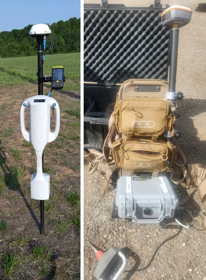
Willowstick integrates three core groundwater methods—MM-ECD (the Willowstick Method), Microseismic Resonance (MSR), and Gamma Scintillation—with LiDAR, photogrammetry, remote sensing, and 3-component EM from our Minerals Canada team.
Our Methods
An integrated toolkit for the subsurface.
Use each dataset on its own or combine them to constrain groundwater pathways, subsurface geometry, terrain, conductive mineral targets, and site change over time.
MM-ECD
Magnetometric Electrical Current Distribution
A patented electromagnetic method that injects a signature alternating current through an area of interest and measures the resulting magnetic field at the surface. Modeling and hydrogeologic interpretation delineate preferential conductive connections associated with seepage and groundwater pathways.
MSR
Microseismic Resonance
A proprietary passive geophysical method that records naturally occurring ground vibrations. Processed resonance patterns help characterize subsurface discontinuities, geometry, and zones that may be conducive to fluid storage or transfer.
Gamma Scintillation
Gamma
A radiometric method that measures spatial variations in naturally occurring gamma radiation near the ground surface. Relative anomalies provide indirect, complementary evidence for lithologic interpretation and groundwater or well-siting investigations.
LiDAR
Light Detection and Ranging
LiDAR measures laser returns to generate precise elevation and terrain models. Willowstick integrates LiDAR with geophysical survey data to support survey planning and place subsurface interpretations in accurate surface context.
Photogrammetry
Photogrammetric Mapping
Overlapping aerial imagery is processed into georeferenced orthomosaics, point clouds, and 3D surface models. These products document site conditions and provide visual context for subsurface interpretation and monitoring.
Remote Sensing
Satellite and Airborne Remote Sensing
Satellite and airborne observations monitor surface change across mines, dams, tailings facilities, and water bodies. Multispectral imagery supports reflectance-based indicators; InSAR or repeat elevation data can measure ground displacement such as subsidence.
Triaxial EM
3-Component Borehole & Surface Electromagnetics
Through Minerals Canada, three-component electromagnetic surveys measure orthogonal field responses in boreholes and at the surface. Vector data help constrain conductor orientation, continuity, and geometry for geologic interpretation and drill-target prioritization.
MM-ECD, MSR, and Gamma Scintillation provide different groundwater and subsurface constraints. LiDAR and photogrammetry add surface geometry; remote sensing tracks method-appropriate surface change; and Minerals Canada provides 3-component borehole and surface EM for conductor targeting in mineral exploration.
The Difference
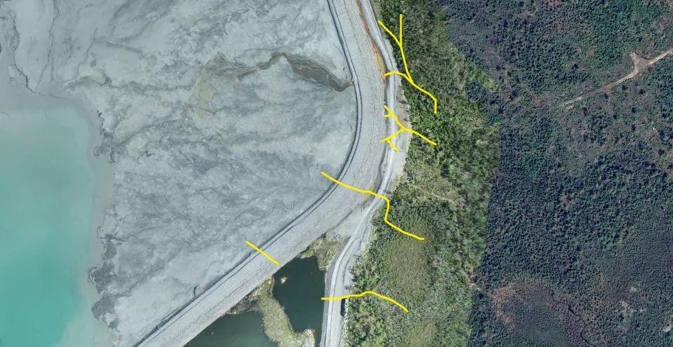
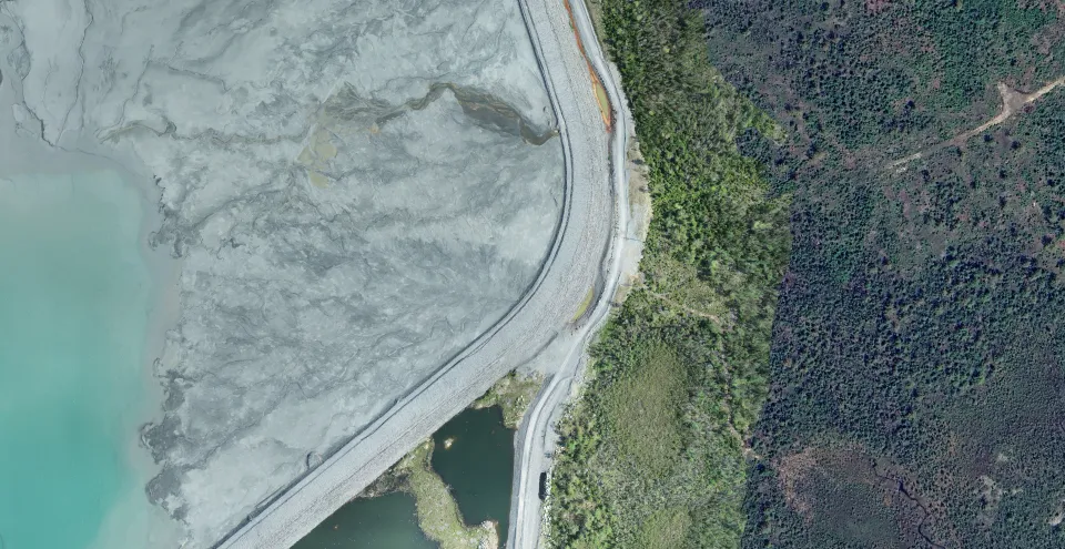
From the surface, you see nothing.
A wet spot, sinkhole, or boil may be the first visible expression of a seepage problem developing below ground. Willowstick adds spatial geophysical coverage to help resolve preferential pathways between direct observation points. (Tap to scan.)
Six Steps
How an MM-ECD survey works.
The steps below describe an MM-ECD survey, Willowstick’s controlled-source electromagnetic method. Where appropriate, Microseismic Resonance (MSR) adds a separate constraint on subsurface discontinuities and fluid-conducive zones.
Strategically place electrodes
Electrodes are sited to drive current through the zone of interest, for a dam, typically one upstream in the reservoir and one downstream of the structure.
Energize the survey circuit
A low-power alternating current at a signature frequency is injected between the electrodes. Its subsurface distribution responds to bulk electrical conductivity, which is influenced by saturation, pore-water chemistry, clay and mineral content, and geologic structure.
Measure the magnetic field
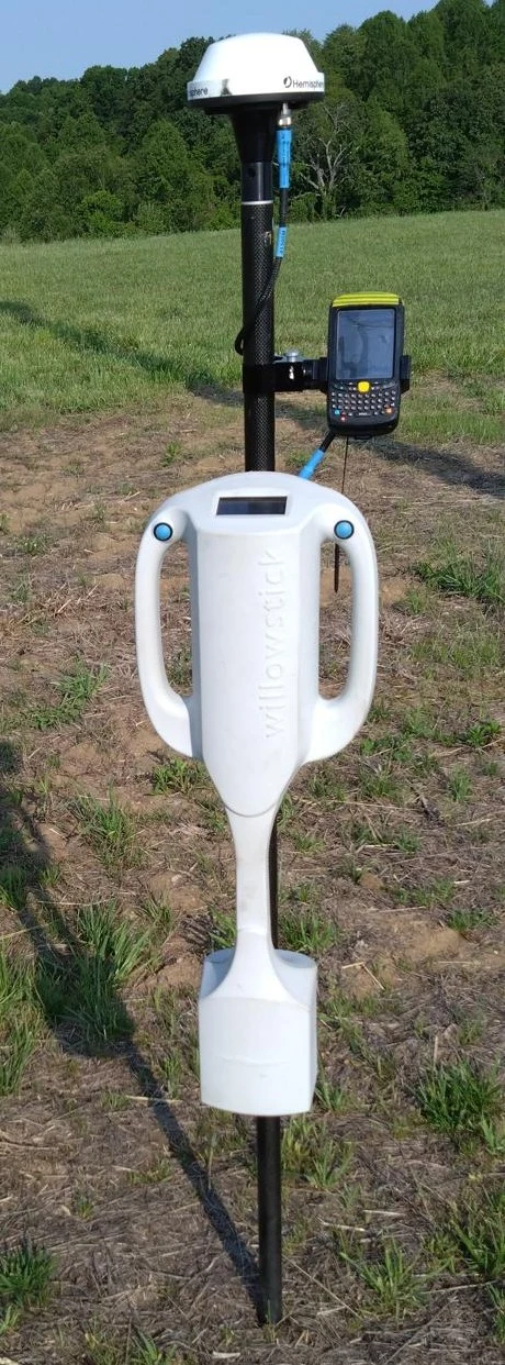
The electrical current produces a magnetic field. Following a georeferenced survey grid, a technician records three-axis magnetic measurements at each station. The magnetic survey itself is surface based; electrode placement is designed for the site and may use existing water bodies, wells, or ground-contact locations.
Compare against a homogeneous model
Observed readings are normalized against the calculated response of a homogeneous-earth model. Departures from that reference identify anomalous electrical-current distributions; they do not, by themselves, uniquely identify water.
Model in 2D and 3D
The measured response is processed and modeled to estimate the subsurface electrical-current distribution. Hydrogeologic information is then used to interpret conductive connections that may represent preferential seepage or groundwater pathways. Depth is model derived and depends on survey geometry, electrode placement, signal-to-noise conditions, geology, and the available constraints.
Deliver coordinates
The final report presents georeferenced anomalies, interpreted pathway targets, model-derived depth ranges where supported, assumptions, and limitations. Engineers can integrate those results with instrumentation, drilling, geology, and site history when planning follow-up or remediation.
Why It’s Different
Point data and spatial coverage answer different questions.
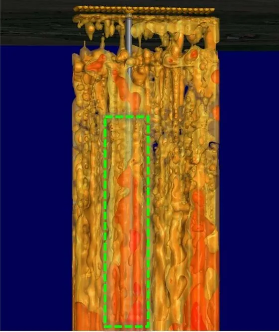
Boreholes, piezometers, and samples provide valuable direct information at specific locations. A narrow pathway can fall between those points. MM-ECD adds continuous surface-grid coverage of the induced-current response, helping teams trace conductive connections across a structure or site.
Non-invasive
Magnetic measurements are collected from the surface. Many surveys require no investigative drilling or dewatering, although electrode placement and site access are project specific.
In operating condition
Where operations and safety requirements permit, surveys can be performed with a reservoir or facility in service so the measured response reflects operating conditions.
Fast
Field acquisition is often completed in days and interpretation in weeks; the actual schedule depends on site size, access, method mix, and data quality.
Transparent
Deliverables document the measurements, processing, assumptions, interpreted targets, and limitations so results can be reviewed alongside other site evidence.
Glossary
The terms, defined.
MM-ECD (Magnetometric Electrical Current Distribution)
Willowstick’s patented controlled-source electromagnetic method. It injects a signature alternating current through an area of interest, measures the resulting magnetic field at the surface, and models the electrical-current distribution. Hydrogeologic interpretation is used to delineate preferential conductive connections associated with groundwater or seepage.
MSR (Microseismic Resonance)
A proprietary passive geophysical method that records naturally occurring ground vibrations. Resonance patterns are processed to characterize discontinuities, relative subsurface geometry, and zones that may be conducive to fluid storage or transfer.
Gamma Scintillation (Radiometric Gamma)
A radiometric method that records spatial variations in naturally occurring gamma radiation near the ground surface. Total-count or spectral measurements can provide near-surface lithologic context; Willowstick uses relative anomalies as an indirect, complementary line of evidence in groundwater and well-siting work.
LiDAR (Light Detection and Ranging)
A remote-sensing method that measures laser returns to create precise elevation, terrain, and surface models for survey planning and geophysical interpretation.
Photogrammetry
The production of georeferenced orthomosaics, point clouds, and 3D surface models from overlapping aerial imagery.
Remote Sensing
Satellite and airborne observations used to monitor surface conditions and change over time. Multispectral imagery supports reflectance-based indicators such as vegetation or moisture response; ground displacement requires suitable repeat-measurement techniques such as InSAR or repeat elevation surveys.
3-Component (Triaxial) EM
Minerals Canada’s borehole and surface electromagnetic surveys measure three orthogonal field components. The vector response helps constrain the orientation, continuity, and geometry of subsurface conductors for mineral-exploration targeting and geologic interpretation.
Conductivity
How readily a material carries electrical current, the inverse of resistivity. Water-bearing zones can be more conductive than surrounding materials, but the response also depends on dissolved ions, saturation, porosity, clay and conductive minerals, temperature, and site geometry.
ERT / IP
Electrical Resistivity Tomography and Induced Polarization are electrical methods that infer subsurface property variations from measured voltage and chargeability responses. MM-ECD measures the magnetic field produced by a purpose-designed current circuit; all three methods require interpretation and can be complementary.
Technical Basis
Selected sources and documentation.
These patents, publications, and agency explainers document the measurement principles and interpretive limits described above. They provide technical context and do not imply agency endorsement or a universal performance guarantee.
Subsurface hydrogeologic system modeling
U.S. Patent US8688423B2 · Willowstick Technologies
Open source ↗System for detecting a location of a subsurface channel
U.S. Patent US9588247B2 · Willowstick Technologies
Open source ↗Subsurface fluid detection
U.S. Patent Application US20250004156A1 · MSR and Gamma documentation
Open source ↗Technical Journal 8 · MM-ECD processing and hydrogeologic interpretation
Atkins technical journal
Open source ↗Aerial gamma-ray surveys and near-surface radioelement response
U.S. Geological Survey
Open source ↗LiDAR point clouds and elevation products
U.S. Geological Survey 3D Elevation Program
Open source ↗Structure-from-Motion photogrammetry products
U.S. Geological Survey
Open source ↗InSAR measurement of land-surface displacement
NASA Earthdata
Open source ↗3-component borehole and surface EM capabilities
Minerals Canada
Open source ↗