
By surveying a canal in operating condition, Willowstick can prioritize reaches with geophysical responses consistent with concentrated seepage. Operators can test those targets against water-balance, inspection, and maintenance data before directing lining or rehabilitation budgets.
Application · Conveyance
Canals
Prioritize seepage reaches along miles of canal without relying on point data alone.
The Problem
Lining the whole canal isn’t the answer.
Conveyance systems lose enormous volumes to seepage, but loss is rarely uniform; a handful of reaches account for most of it. Re-lining an entire canal is capital the operator may not have, and it wastes money on segments that aren’t leaking.
Miles Linear coverage
Reach-level Loss localization
In-service Where operations permit
How Willowstick Maps It
The method, applied to canals.
01
Establish a controlled circuit: electrodes are positioned so a signature alternating current passes through the reach of interest. Its distribution responds to saturation, pore-water chemistry, clay and mineral content, geology, and other controls on bulk conductivity.
02
Measure the response: the Willowstick instrument records the resulting three-axis magnetic field at georeferenced stations on a surface grid. The magnetic survey itself does not require exploratory drilling.
03
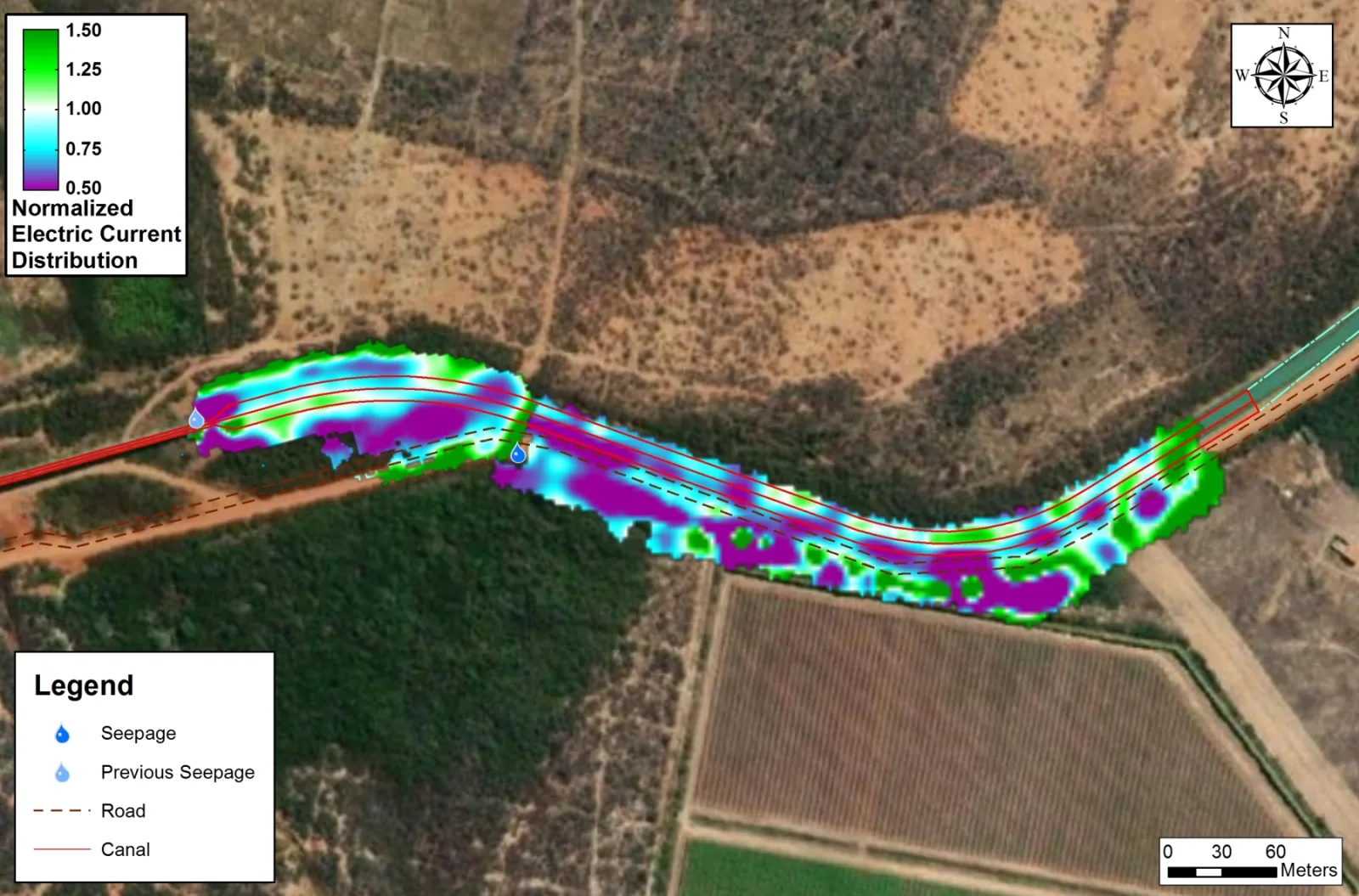
Model and interpret: measured data are normalized against a homogeneous-earth reference and processed into 2D and 3D electrical-current models. Site geology and hydrology guide interpretation of preferential conductive connections that may carry seepage.
04
Deliver reviewable targets: the report presents mapped anomalies, interpreted pathway targets, model-derived depth ranges where supported, and the assumptions and limits needed to plan follow-up or repairs.
Proof
Relevant case studies
Start Here
See what’s moving beneath your canals.
Field acquisition is often completed in days and interpretation in weeks. Timing, depth of investigation, and deliverables are scoped to the site, method mix, and decision.